 It's a new year!
Have you made any resolutions?
Maybe you've made a resolution related to healthier living, body conditioning, improving your mental facilities, etc.
As a GIS professional, I want to encourage you to make a resolution this new year to make metadata. Metadata (follow this link for an example) is a file that describes the purpose of a file, who created it, when they created it, how they created it as well as information about the quality and accuracy of the data. Metadata is an interpretive file, that is important, though often overlooked, when creating data creation. Making metadata has benefits to you - the data creator, benefits to those using your data, as well as benefits to your organization.
- YOU (DATA CREATOR) >>> metadata provides documentation of how, when, and why you created the file. This is helpful especially if you are doing analysis with multiple process steps or over a period of time.
- ORGANIZATION >>> metadata helps build institutional memory into the data. If an organization is willing to spend hundreds or thousands of dollars creating a data set, they should require their workers to take a few minutes to write metadata. This will be the guide book to the data set long after an employee has moved on to another project or position.
- DATA USERS >>> metadata helps data users have a better understanding of what information a file contains and how it was made. Good metadata can help data users easily decide whether it's worth their while to download a file. Metadata also is a helpful tool to help data users find your information through data discovery tools such as the Iowa Geospatial Data Clearinghouse or gisinventory.net.
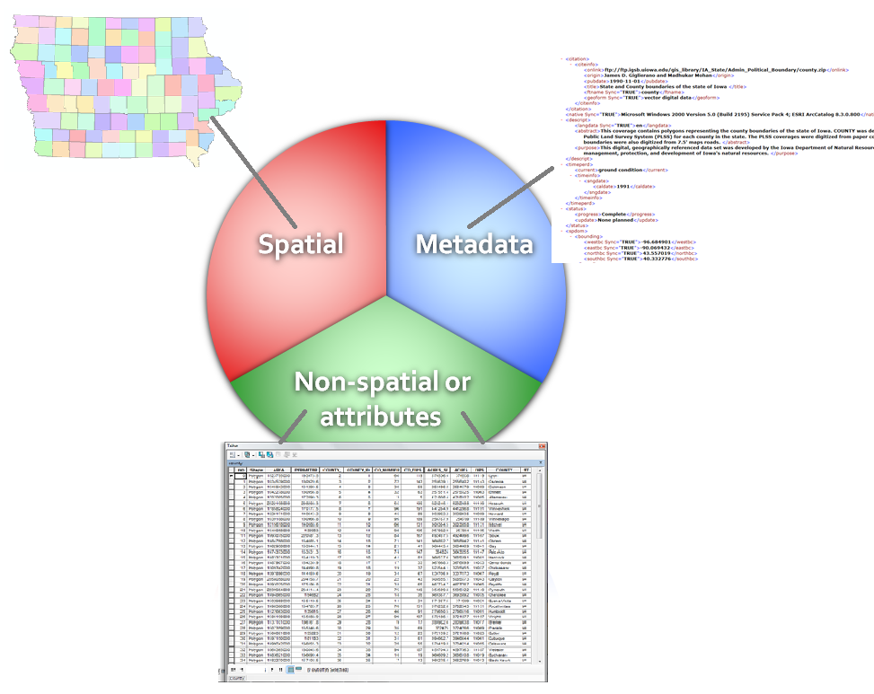 | ||
| A complete GIS file has a spatial component (map), attribute information (table), and metadata (interpretative information) |
When will this become a normal part of data creation!?!
ReplyDelete